Boat Electronics (and instruments) upgrades

Currently we have a Raymarine Sea Talk system, we have the following instruments and devices:

At the helm:

Raymarine E120 chart plotter/radar/AIS (set as the slave)

Raymarine autopilot

Above the hatch:

ST60 Water speed

ST60 Wind direction/speed

ST60 Depth

At the Navigation station:

Raymarine E120 Chart plotter/radar/AIS (master)

Brass clock

Brass Barometer

There is a camera in the engine room. It is mounted at the forward end and is looking back at the engine. This camera can only be viewed at the hem, and it is the only camera on the boat.

Issues with this equipment:

  1. The chart plotter occasionally loses its self, the slave can’t see the master and it requires a reboot. (This happens several times a week).
  2. All of the above is about 2005 vintage, which means that the charts are at least 15 years old
  3. The wires are uncoated single strand wires that are starting to show signs of age and corrosion
  4. The water temperature instrument is non functional (it is part of the depth instrument).
  5. The depth instrument is starting to get a bit flakey, giving false readings (thankfully always showing it to be shallower than it is).

What I want in the way of instrumentation and electronics:

  1. Wind speed/direction
  2. Depth/temperature
  3. Speed through the water
  4. Chart plotter/radar/AIS
  5. Forward scanning sonar displayed on the chart plotter (assuming it is better than what is currently available, meaning right now it is only good for about 30 feet in front of boat)
  6. Auto pilot
  7. Cameras that go to either chart plotter and possibly the TV, all set up to be recorded:
    1. Engine room (where the current camera is)
    2. Engine room looking at Alternator Regulator
    3. Bilge (infared looking down)
    4. Looking at the shaft seals
    5. Aft Lazerette looking at the water-maker instruments/controls
    6. Top of the mast looking forward and adjustable to cover at least 180 degrees
    7. Top of the mast looking backwards and adjustable to cover er at least 180 degrees
    8. Mounted on the arch behind the cockpit and looking forward to watch what is happening in the cockpit
  8. Engine instruments that go to the chart plotter(s)
    1. Oil temperature
    2. Oil pressure
    3. Engine RPM
    4. Water temperature (engine coolant)
  9. Generator instruments that go to the chart plotter(s)
    1. Oil temperature
    2. Oil pressure
    3. Engine RPM
    4. Water temperature (engine coolant)
    5. Generator Voltage
    6. Generator frequency
    7. Generator Amps (load)
  10. Battery instruments that go to the chart plotter
    1. Battery voltage
      1. House bank
      2. Engine start battery
      3. Generator start battery
    2. Battery percentage used (house bank only)
    3. Battery amps
      1. House bank
      2. Engine start battery
      3. Generator start battery
  11. Charts that can be updated, preferably open source (like OpenCPN for example)
  12. At the Navigation station
    1. Brass clock (the one that is there is fine)
    2. Brass barometer (one that works)
    3. Brass air temperature/humidity

While it would be great if all of the above were available on WiFi, it is more important that they are reliable.

Raymarine is what I have, but does not have to be what I have going forward. The Raymarine representative in San Diego really ticked me off, so I am not inclined to go with them again. There is also the issue of a  proprietary network that I can’t add anything too. I have heard good things about B&G, and I am open to hearing about other options.

Since we are removing the mast when we do the great loop trip, the conduit in the mast will be repaired/replaced. All wires/cables in the mast need to have easy disconnects at the bottom of the mast.

Our boat and spare parts

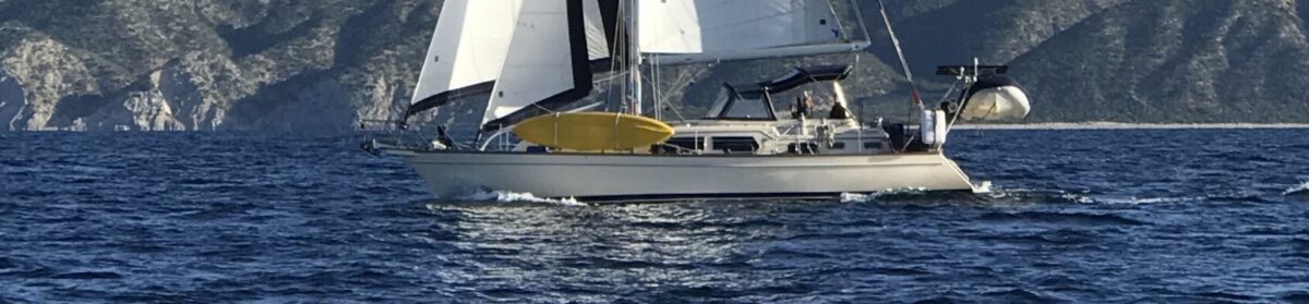
We have IP 445-11, S/V Make Me Laugh Again. This boat saw a quite a bit of use before we got it. I went through the spares and fixed everything I could before we left San Diego and headed to Monterey, Ca and back (this was a shake down cruise). We spent a month and ran every system to see what needed help. Then when we got back to San Diego we checked our spares, as we were headed south into Mexico. We left San Diego on Oct 31 this year. We are currently in Guaymas, Sonora Mexico. I have used almost none of the planned spares, and have wished for a bunch of stuff. BUT we are in Mexico, and can’t get them without a bunch of work and $$$$. 

So, four months into cruising in Mexico here is what I wish I had:

    1. Fasteners, every size, that is already on the boat, all in Stainless, 
    2. Replacement screws/bolts and nuts for the life line stanchions (apparently they used sub par material for these in 2005). I have two broken ones, and I have read here on FB many other 445, 465 & 485’s have the same issue. The fasteners break and can be picked up with a magnet. Not exactly something you expect from stainless steel.
    3. A hinge pin, one too many accidental gybes, and it broke. 100 miles south of Ensenada, a little fishing village without cell service, and only about 30 little houses. (The hinge pin I am referring to is part of the goose neck). A $150 part, and $150 to get it delivered to where we were, and about 15 minutes to install after waiting 3 days for it.
    4. A second spare outboard prop. Just hit a rock with the first one, for the second time. We hammered out the prop the first time (thanks Josh Fox!), but lost parts of the blade the second time. Now I don’t have a spare.
    5. More engine & generator oil. Seems like we always want to go when the wind is from the wrong direction, and oh by the way all the extras that come with these boats use a lot of power.
    6. A spare wind speed sensor, they cost about $324 in the states, and will be delivered overnight. In Mexico, it costs a bit more and will take a bit longer to get it. (The estimate was about $150 in taxes and shipping and probably one to two weeks, if it actually arrived).

The spares that I figured I had to have on board before we left:

    1. Spare potable water pump
    2. Spare bilge pump
    3. Spare shower drain pump
    4. Spare A/C sea water pump
    5. Spare impellers for the engine
    6. Spare impellers for the generator
    7. Spare water pump for the engine
    8. Spare water pump for the generator
    9. Spare alternator for the engine
    10. Spare alternator for the generator
    11. Spare parts for vacuu-flush heads (lots of spare parts)
    12. Spare pumps for the water maker (I have an A/C system, and did not get these spare pumps, but probably should have).
    13. LOTS of filters 
    14. Spare blocks for the rigging that you will figure out you want after you are away from the shops.
    15. Spare line to use in the spare blocks.
    16. Sail repair kits, for the tears that happen.
    17. Spare microphone(s) for the radio(s)
    18. Spare parts for the washer/dryer
    19. TefGel for all the things you take apart and put back together again
    20. Grease 
    21. Hose clamps, a large variety of sizes.

MORE MOVIES that both (all) of you want to watch.
Books, cruising guides for where you plan to go.

Charts, Paper vs Electronic

I ran across this post today (03/30/2020) on FaceBook:

Cell Phone Skipper. With so many good navigation apps its simple to navigate using a smartphone or tablet, but those devices can stop working at inopportune times. A good skipper should have paper charts onboard and know how to use them. Learn the basics and stay safe on the water with this Free e-Book: https://coastalnavigationpro.com/freebie/

My answer to that suggestion is as follows:

It is important to note that the world is changing and moving away from everything paper. In the case of paper charts, the governments of the world are stopping printing of paper charts. They are no longer mandatory to have on board, (charts are required, they just don’t have to be paper). We have some paper charts on board but not to the scale that would be required (or even desired) for the locations we might anchor in.

What we do have is a variety of ways to figure out where we are:

GPS receivers:

  • Chart plotter
  • VHF radio
  • VHF handheld radio
  • SSB radio
  • Iridium GO! 
  • iPhone (3 of them)
  • iPad (2 of them)
  • Hand held GPS
  • EPIRB

Map software systems on board:

  • Chart Plotter (two 12” chart plotters, both get the GPS signal, one has the charts in it and is set as the “master”.
  • MacBookPro with OpenCPN
  • Windows 10 laptop with OpenCPN
  • iPads (2)
  • iPhones (2)

As a point of reference, on my boat there are three separate GPS antenna’s not counting the Iridium external antenna, and if the external antenna fails, I can unplug and the local antenna works.

I keep guide books for places to go where I sail, for example I am in the Sea of Cortes, and we have at least three guide books for harbors and ports and places of interest with descriptions of the various anchorages. All of the books include LAT/LON information. We have a couple of large scale maps for this area as well.
I have the electronic charts on the Chart plotter and OpenCPN on two laptops, one MacBookPro and the other a Windows 10 device. 

On top of all this, I keep aware of where I am, reviewing the electronic charts for where I am going, and where I am at.

So, What if?

  1. What if the GPS system is turned off, I will park the boat in a suitable anchorage near where we are and wait for it to come back on. I am in no particular hurry, we don’t sail when we expect storms (much more of a concern to me than a loss of GPS signal), or high winds. The likelihood that even in time of war the system will remain off for an extended period of time is pretty low. The impact to all forms of shipping and air traffic and basically all forms of transportation are just too high.
  2. What if one of the GPS systems fails, like the chart plotter? See one of the redundant systems
  3. What if we take a lightening strike and lose all electronics? I have some large scale maps and books, and since I am aware of where I am most of the time, I will go anchor somewhere nearby and figure out how to find someone that was not affected by the strike. There are lots of other boaters around, we have been down here for 5 months, and have only had about two nights at anchor by ourselves, no matter how far from cities, even coming down the west coast of Baja, hundreds of miles from anything.
      1. What about the “GREAT” Paper charts? Well, we made the trip from Corpus Christ, Tx to Tampa, Florida in 2013 on the ICW. We struggled to find paper charts, as I really wanted to have them on board. Very quickly we found the best paper “charts” for this stretch of the ICW were the PLACEMATS in the various restaurants along the ICW, and they matched almost perfectly the electronic charts that were available.

I am not a fan of paper charts, they don’t get updates, and even if that is my fault, where am I supposed to get the updates? Oh yeah, electronic. So, we have old charts, we have manual updates, and I have to figure out where I am on a particular chart. Which of course won’t be as high of resolution as would be available on even the most basic of a chart program/chart plotter, because I am not going to carry a complete library of charts for everywhere I am going to go, For example, since October 31, we have sailed approximately 1,000 miles straight line distance or closer to 2,000 miles with all the side trips and back and forth. The high resolution fine scale charts that we would have needed would have been very difficult to keep track of while on a sailboat. I would much rather have easy to use, always available electronic charts that show where I am at a glance. With the resolution and scale appropiate to what I am looking at, and easily adjustable as I change the scale on my chart plotter/radar/AIS screen.

In the case of the Great Loop, where virtually the entire time you are on the water, you could see both banks, and you have a compass. You should be able to figure out where you are.